
$ 90,000 will be paid to update the mapping of flood zones in the Outaouais
$ 90,000 will be paid to update the mapping of flood zones in the Outaouais
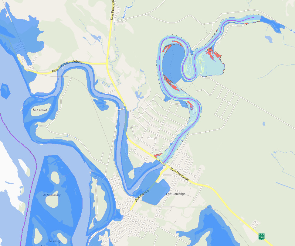
$ 90,000 will be paid jointly to the city of Gatineau and the MRCs of Papineau, Pontiac and Collines-de-l’Outaouais to update the mapping of flood zones. The Minister of Municipal Affairs and Housing, Ms. Andrée Laforest, made the announcement concerning the granting of this sum of $ 90,000 for the territories to continue updating the mapping of flood-prone areas, taking into account risk management.
“To ensure the safety of citizens and the protection of our living environments in the face of flooding, it is crucial that the mapping of flood-prone areas be updated. Our government is working hard in this direction for the good of all. With this bonus of $ 2.79 million, we are helping to create a better portrait of the risk areas and prevent the social, environmental and financial consequences linked to flooding ”
– Andrée Laforest, Minister of Municipal Affairs and Housing
This work will allow them in particular to deepen their knowledge of the flooding problems of their territory and thus contribute to better management of flood-prone areas.
“In efforts to foster resilience in the face of climate change that has hit us hard recently – torrential rains, floods, heat waves, and more – there is a need to mitigate the impact of these phenomena on citizens and the communities. This is why updating the mapping of flood-prone areas in the Outaouais region, taking into account risk management, is a concrete measure that will undoubtedly not only allow us to learn more about the problems of flooding but will undoubtedly contribute to better management of flood zones ”
– Chantal Lamarche, president of the conference of Wardens of the Outaouais and Warden of the MRC de la Vallée-de-la-Gatineau
It should be noted that the aid granted is part of the implementation of measure 3 contained in the Territorial protection plan against floods, ie mapping the hazards of flooding at the watershed scale. The land protection plan against floods: sustainable solutions to better protect our living environments, released on April 3, 2020, includes 23 measures and an investment of more than $ 479 million.